From the point of view of its end-users, a drone’s purpose is simply an Eye-in-the-Sky i.e. a flying platform equipped with a camera, that allows them to to see interesting things and places beyond their line of sight. From the point of view of Aviation Authorities, things are not so simple: usage of UAV (Uninhabited Air Vehicles) in the airspace is only beginning to get accepted and is closely controlled. The operators (the « pilots »), the airframes and the software must abide by regulations and be certified before being allowing flight and ultimately providing service as an Eye-in-the-Sky.
Integrated coastal Zone Management via Increased situational awareness through innovations on Unmanned Aircraft Systems
Enabling Cooperation in UAV Systems
The classical usage scenario of a mid-sized UAV system is to have two certified operators in charge of the system (a pilot operator and payload/camera operator) while the end-users somewhat manage to look over their shoulders to look at the data and express requests as they can (scribbling things on a map, pointing, shouting, etc.) There is obviously an opportunity to develop dedicated collaborative software (CSCW) to smooth this process, but modifying the control software implies to certify it all over again; a costly and long process. Therein lies a tension between satisfying the rapidly evolving needs of the end-users and the necessary cautiousness of regulations.
In the framework of the Interreg IV A project 3i, Deev Interaction has developed together with Télécom Bretagne an innovative activity concept in order to alleviate this tension.
Official website of the project: www.2seas-uav.com
Official website of the Interreg IV A 2 Seas program: www.interreg4a-2mers.eu
Architecture
In order to allow the end-users to send requests to the operators without modifying the certified control softwares of the drone, we make use of the ability of these software to receive data via network connections. In the following illustrations, software and other part of the system that are certified by Aviation Authorities are represented in green, while blue denotes parts of the system dedicated to the activity of the end-users.
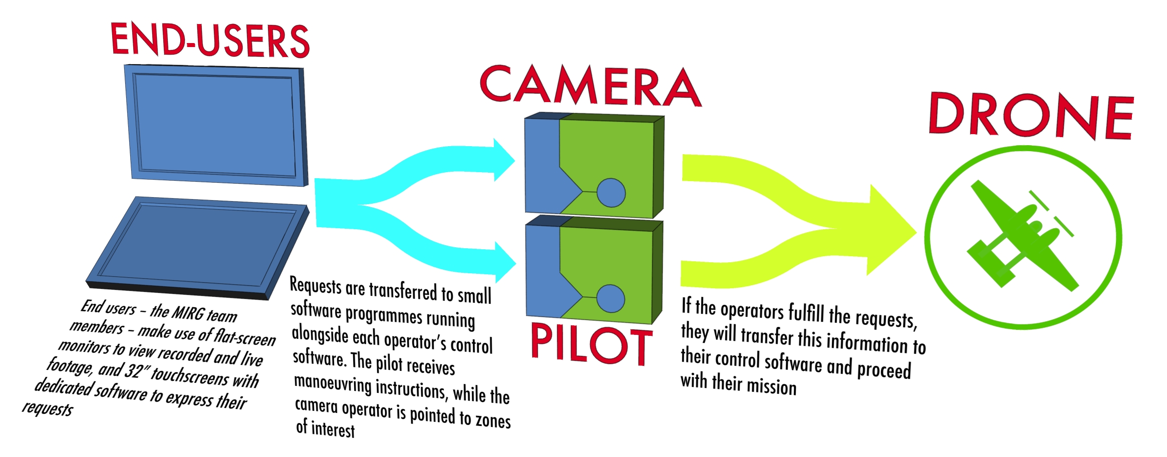
The key in keeping full control responsibility with the operator is to have a piece of dedicated client software running on each operator’s workstation that is able to receive requests from the end-users’ touchscreen interface which acts as a server. This client allows each operator to visualize requests and to create some inactive waypoints or reference within their main control software. This is done with a single click and is under their sole responsibility. After this step, the operator has to activate these waypoints or references so that the drone changes its course or re-orient its camera.
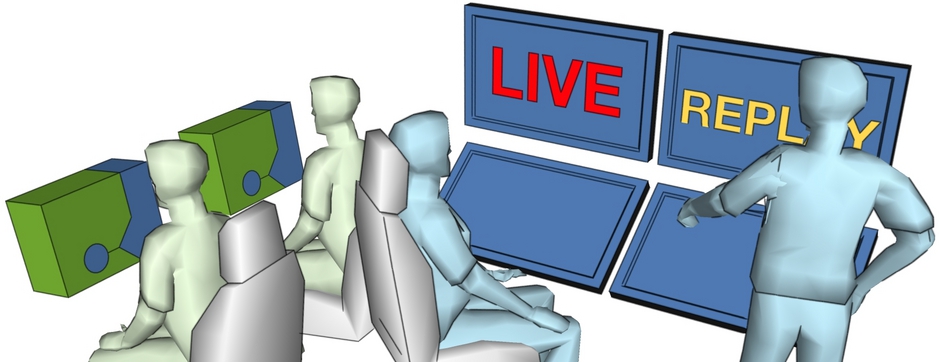
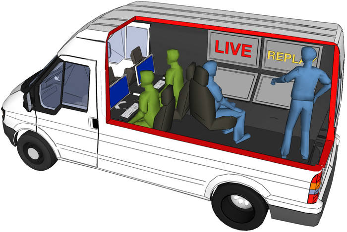
This setup is integrated inside a van, with the two operators and the end-users sharing a small workspace. This co-localization allows rich interpersonal communication. Our software system does not aim to be the sole medium of communication, but to replace and facilitate technical cumbersome interactions like scribbling on a map, trying to designate an area or directing video playback orally. Everyone has its own workstation, but they can share some data and the possibility still exists to simply look over one’s neighbor’s shoulder and point.
End-Users’ Dedicated Control Software
Detailed description of the software is forthcoming, for now, below is a video of the work in progress.
Partnership & Funding